|
|
||
|
|
x Figure A. View of uppermost section of gorge trail, close to King Road. June 2022 x |
|
. |
||||
| . . |
Home | Ecology Main | Documentation | . |
| . Plant Ecology of the Area Surveyed Gorge Trail - Eastern Plateau . |
||||
|
|
||
|
|
x Figure A. View of uppermost section of gorge trail, close to King Road. June 2022 x |
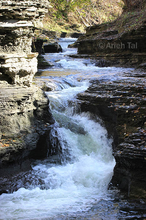
| For hikers of the gorge trail coming up from the bottom of the hill, the Eastern Plateau subsection is the final stretch, approximately 150 yards, from just after Pinnacle Rock to the stairs at King Road. For most of this subsection, the trail is flat, wooded or open-wooded, disturbed ground. The relatively slow-moving creek runs |
| parallel to the trail until it reaches a series of low rocky
steps, and then begins to tumble over the descending ground, gaining
momentum and power as it falls. It meanders for a way, twisting and
turning until it reaches Pinnacle Rock, whereupon it crashes over a
dramatic double waterfall with great force.
The thinner forest canopy here allows more sunlight to reach the ground than in the previous subsections. And because the terrain on either side of the creek isn't very tall or steep, the ground is somewhat drier. It's also a bit warmer than in the internal subsections of the gorge. Not surprisingly, plant diversity is greater, and there are more non-native, opportunistic species. Of the numerous species here that are unique to the gorge trail, the following is a partial list: white snakeroot*, bitternut hickory, northern hackberry, honewort, spicebush, sensitive fern, common elderberry, multiflora rose, and heart-leaved aster. The above description refers to the south bank of the creek, including the trail. The opposite bank of the creek is quite different, and does approach a natural community akin to a "river bar"; that is, slightly elevated ground that is damp for much of the year, and occasionally becomes flooded during times of high water flow. |
x Figure B. Origins of Buttermilk falls in Eastern Plateau, Nov. 2018. |
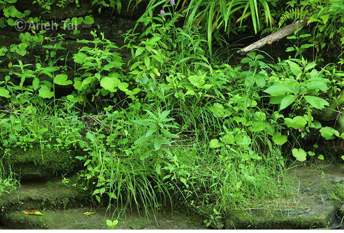
| The difference in ecological conditions between the south bank of the creek (including the trail) and the north bank is striking. The north bank is more of a natural wetland community, though there are some non-natives present, such as coltsfoot* and heal-all. | ||
 |
||||
|
|
Figure
C. View of portion of the north bank of Buttermilk Creek, and
associated vegetation, July 2019. |
|||
|
* To convert English plant names to their scientific equivalents, click this link. |
.
|
. |
.