|
|
||
|
|
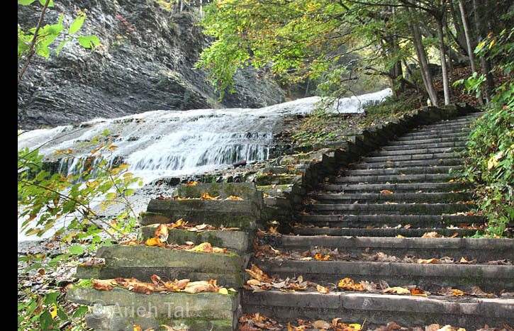
Figure A. "Initial Ascent" section of gorge trail, October 2018, showing main falls and lowest set of stairs. South is to the right. | |
| The
"Initial Ascent" section of the gorge trail at
Buttermilk Falls State Park includes the terrain along the lowest set of
stone stairs. These 100+ stone stairs run closely along the edge
of the main falls, which is visible at all times. They end
shortly after reaching the large observation platform on the south side
of the creek.
The terrain through which these stairs pass is extremely steep. The summit of the hill lies high above, unseen, on the south side of the creek. These stairs pass through a dense, mixed forest of towering eastern hemlock*, red oak, basswood and black and yellow birch. The northern exposure of the hill ensures that very little sunlight penetrates the forest canopy. Surviving plants need to be well adapted to living in continual shade. Understory plants are sparsely distributed above, but are somewhat more prevalent immediately adjacent to the stairs, and within the narrow sliver of ground at the edge of the falls. |
||


